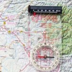
Bring your map and compass - they come in handy out here!
For as remote as the ranch is, we are surprisingly easy to find! We are located on the New Mexico-Arizona border, roughly six hours east of Phoenix, at 33° 17.5′ N 109° 24.4′ W.
By car
- Take Hwy 191 north of Morenci or south of Alpine to mile marker 188.
- Despite being the middle of the national forest, at mile marker 188 there is a large green street sign for Upper Eagle Creek Road. Take this turn (west).
- Go just under four miles on Upper Eagle Creek Road and turn left at the first driveway. There is a mailbox on the left, and the Forest Service maintains a small outpost on the right. We have a large parking lot and a turnaround area down below, so fear not if you are coming in with a trailer.
A few important notes! Please allow yourself LOTS of driving time. Hwy 191 is the second most winding road in the country, with lots of switchbacks and sheer dropoffs down the side of the mountain. For several stretches, the speed limit is 10 mph. Do not try to rush this trip. Also, when the sign says “Next services 90 miles” it really means it! Be sure to fuel up in Morenci or Alpine. Finally, your cell phone will not work for the last 20 miles or so of the trip, nor will it work here at the ranch. Plan accordingly!
By air
The Phoenix, Tucson and Albuquerque airports are all fairly accessible from the Double Circle Ranch. Phoenix is about 6 hours, Tucson is about 5 hours, and Albuquerque is a little over 7 hours away.


